Readers:
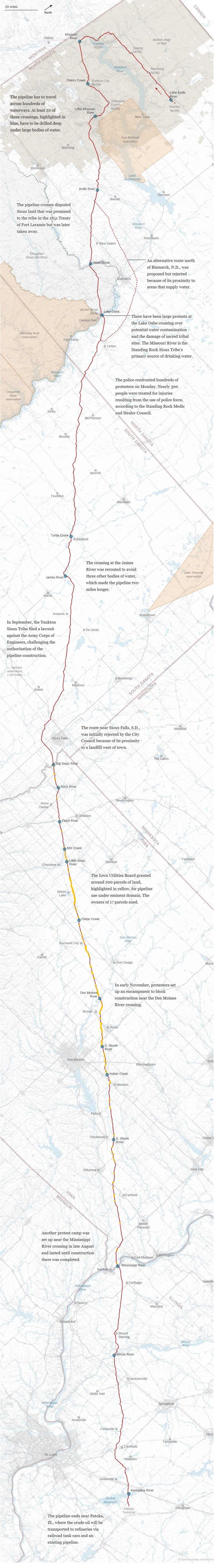
GREGOR AISCH and K.K. REBECCA LAI, of The New York Times, have created a great visual of a map that shows the conflicts along the 1,172 miles of the Dakota Access Pipeline. Key altercations have been noted as you scroll downward through the map. Also, blue circles indicate where the pipeline crosses rivers, a point of real concern, especially where plans are to have the pipeline underneath the Mississippi River, which is a recipe for a potential disaster in the making.
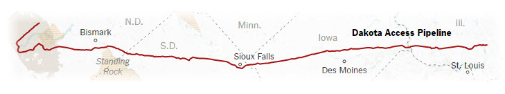
The construction of a crude oil pipeline through four states has spurred months of clashes near the Standing Rock Sioux Reservation in North Dakota. Protesters, concerned about the pipeline’s environmental impact, have been trying to stop the construction of its Missouri River crossing.
Though legal disputes about water safety, Native American lands and eminent domain have delayed the project, the pipeline is nearly complete.
I hope you enjoy grazing this map as much as I did.
Best Regards,
Michael
The Conflicts Along 1,172 Miles of the Dakota Access Pipeline
Sources:
GREGOR AISCH and K.K. REBECCA LAI, The Conflicts Along 1,172 Miles
of the Dakota Access Pipeline, The New York Times, November 23, 2016, http://www.nytimes.com/interactive/2016/11/23/us/dakota-access-pipeline-protest-map.html?smid=pl-share.
Energy Transfer (pipeline); bakkenpipelinemap.com via Nitin Gadia of MapStory.org (properties under eminent domain); Carl Sack (alternate route and 1851 Sioux territory)
