
Readers:
As many of you know, I love maps.
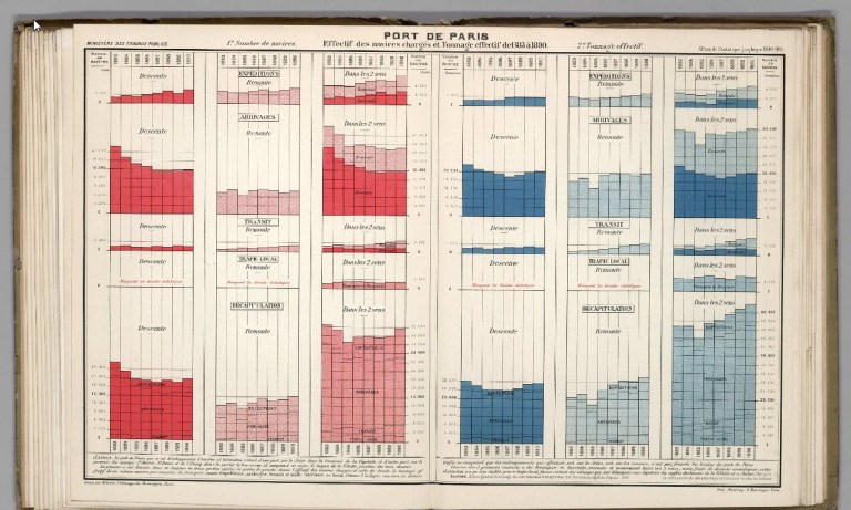
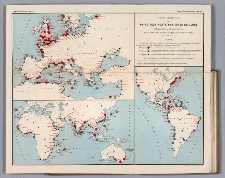
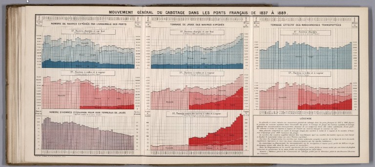
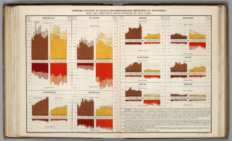
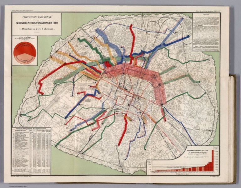
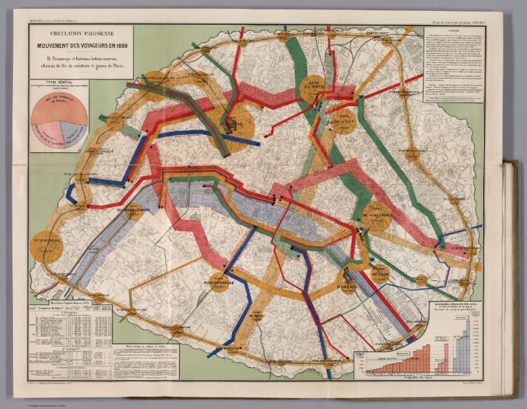
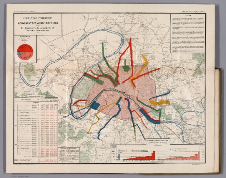
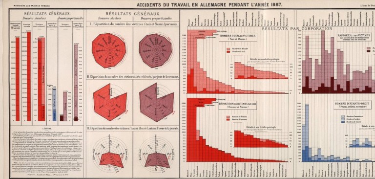
I was browsing through the David Rumsey Historical Map Collection, and came across this book of statistical graphs published by the Ministry of Public Works (Civil Engineering).
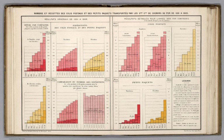
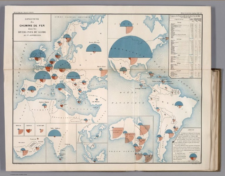
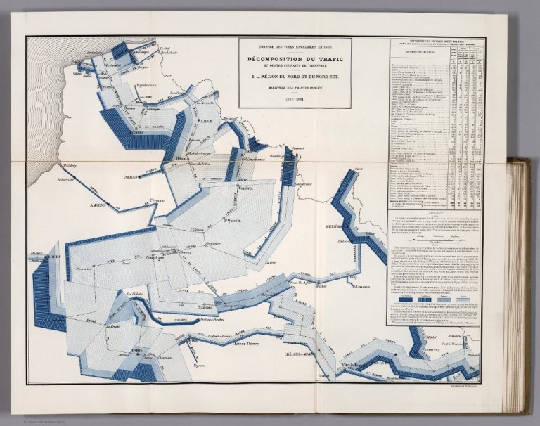
This atlas is one in a series of annual or biannual editions from the period 1879 – 1900. Most of the maps have a detailed inset showing the map’s theme as it applies to the vicinity of Paris. The maps were inspired by the earlier work of Charles Joseph Minard. Émile Cheysson created these Albums of Statistics for the French Ministry of Public Works.
I have shown below a few examples of the maps and graphs from this book.
I find these maps and graphs to be both beautiful and incredible for the painstaking effort put into creating each one without the help of computers and software tools like Tableau or ARCGIS to create them.
Best Regards,
Michael

Source: Rumsey, David, Ministere des Travaux Publics. Album de Statistique Graphique de 1890-1891, Paris. Imprimerie Nationale. M DCCC XCI,
David Rumsey Historical Map Collection, https://www.davidrumsey.com/ll/thumbnailView.html?startUrl=%2F%2Fwww.davidrumsey.com%2Fluna%2Fservlet%2Fas%2Fsearch%3Fos%3D0%26mid%3DRUMSEY~8~1~309552~90079442%26sort%3DPub_List_No_InitialSort%26bs%3D10.

i just wanted to say that i love reading your blog posts ❤