The Lionel Pincus & Princess Firyal Map Division, New York Public Library (NYPL) has announced the release of more than 20,000 cartographic works as high-resolution downloads. The New York Public Library believes these maps have no known U.S. copyright restrictions.* To the extent that some jurisdictions grant NYPL an additional copyright in the digital reproductions of these maps, NYPL is distributing these images under a Creative Commons CC0 1.0 Universal Public Domain Dedication. The maps can be viewed through the New York Public Library’s Digital Collections page, and downloaded, through the Map Warper. You will first need to create an account, then click a map title and go.
Here’s a primer and more extended blog post on the warper.
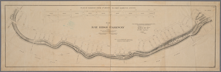
Plan of Bay Ridge Parkway, Olmsted, Olmsted & Eliot Landscape Architects, 1895
What’s this means for all of us map lovers?
It means you can have the maps, all of them if you want, for free, in high resolution. NYPL has scanned them to enable their use in the broadest possible ways by the largest number of people.
Though not required, if you’d like to credit the New York Public Library, please use the following text “From The Lionel Pincus & Princess Firyal Map Division, The New York Public Library.” Doing so helps them track what happens when they release collections like this to the public for free under really relaxed and open terms. NYPL believes their collections inspire all kinds of creativity, innovation and discovery, things they hold very dear.
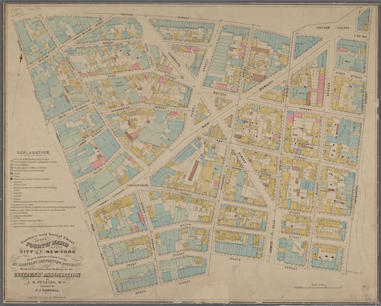
Sanitary and social chart of the Fourth Ward of the City of New York, to accompany a report of the 4th Sanitary Inspection District. 1864
* The maps may be subject to rights of privacy, rights of publicity and other restrictions. It is your responsibility to make sure that you respect these rights.
———————————————————————————-
Source: Matt Knutzen, Open Access Maps at NYPL
