Readers:
I have been really busy at work the past week or so and have not been able to post any blogs. Yesterday, I was looking at transit maps on the great site, http://transitmap.net. I thought I would share ten of them with you that I found interesting.
Enjoy!
Michael
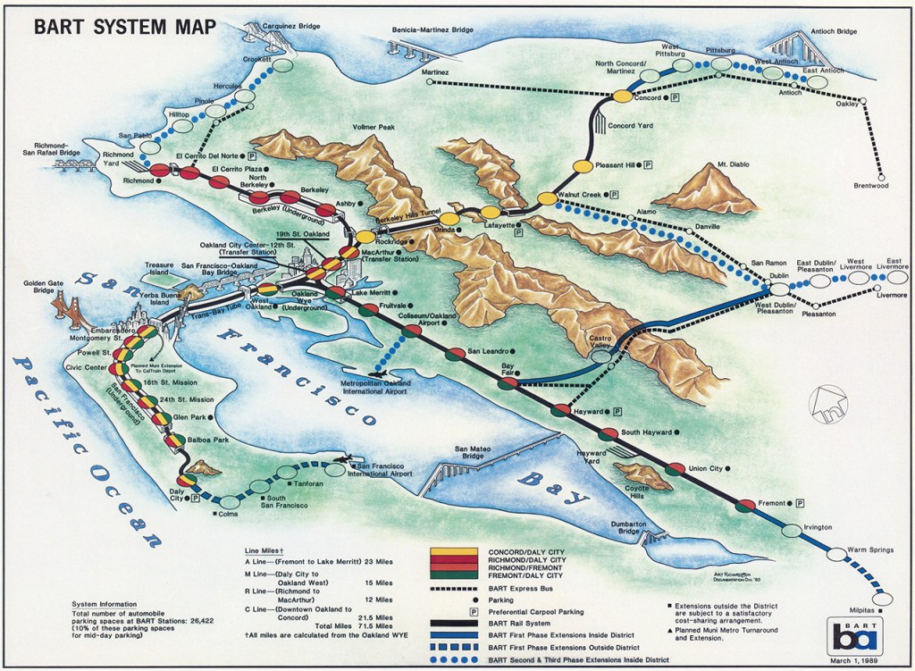
Historical Map: BART System Map and Planned Extensions, March 1, 1989
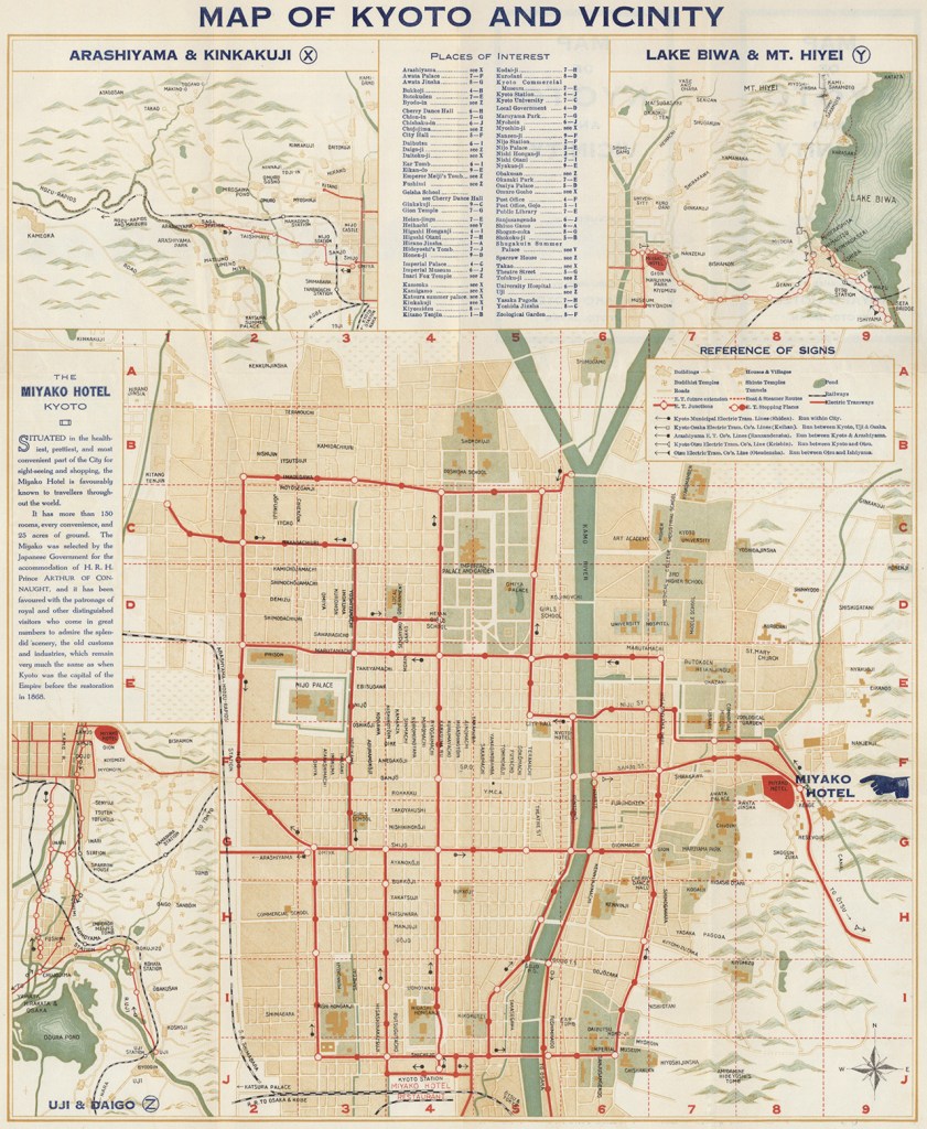
Historical Map: Map of Kyoto and Vicinity, 1920
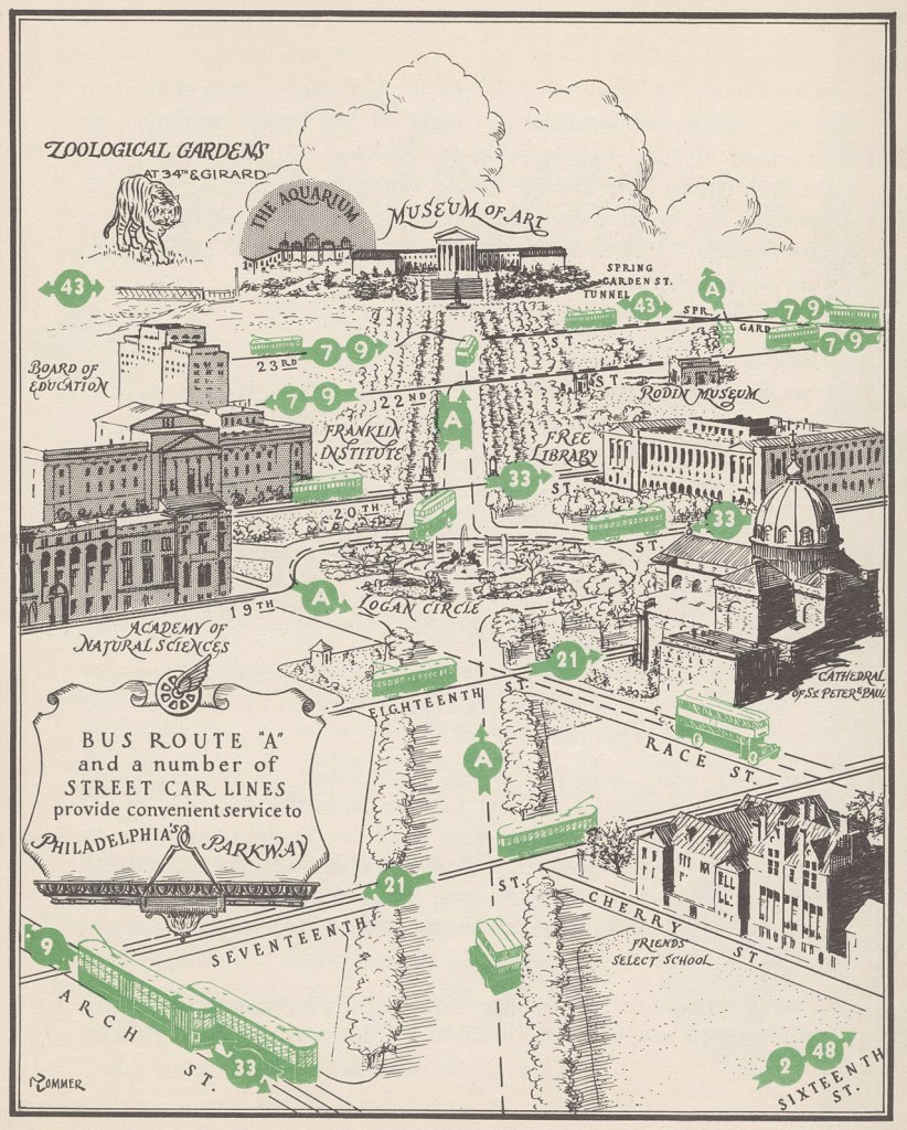
Historical Map – Bus and Streetcar Lines on the Benjamin Franklin Parkway, Philadelphia, c. 1935
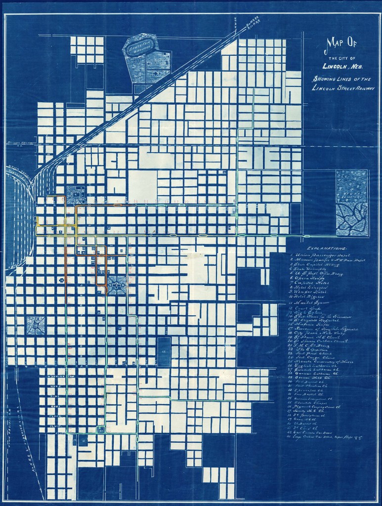
Historical Map: Lines of the Lincoln, Nebraska Street Railway, 1892
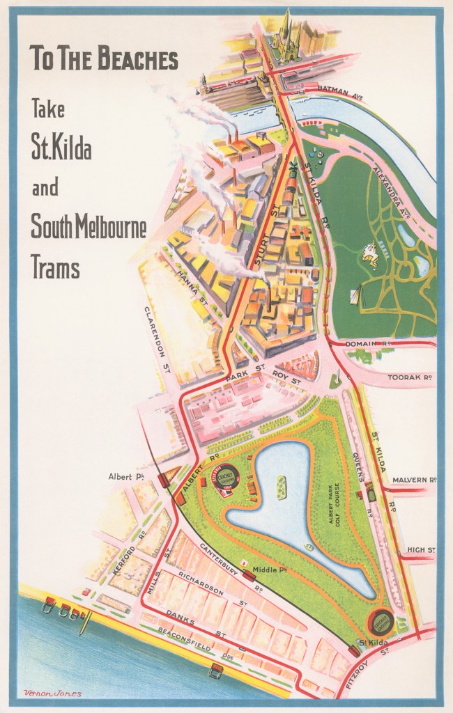
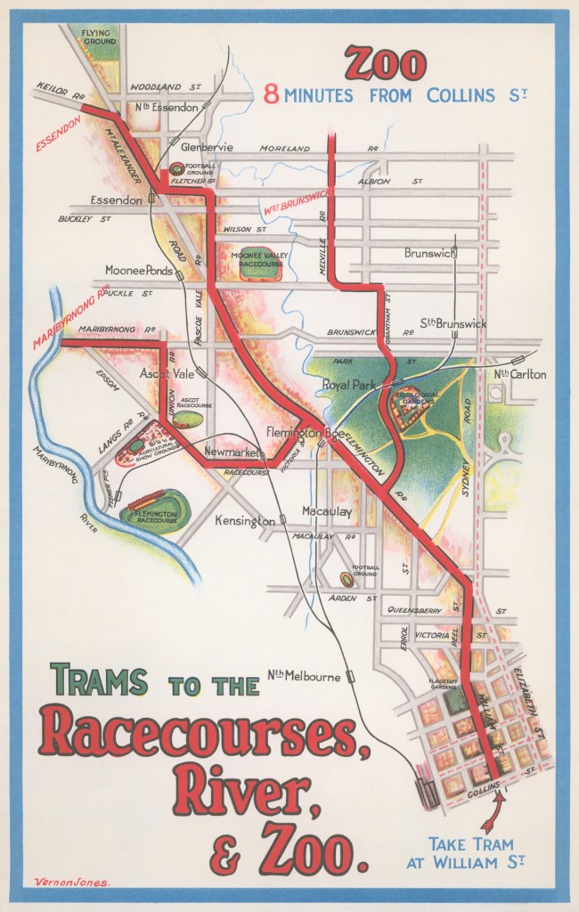
Historical Maps: Melbourne Tram Destination Posters by Vernon Jones, c. 1930s
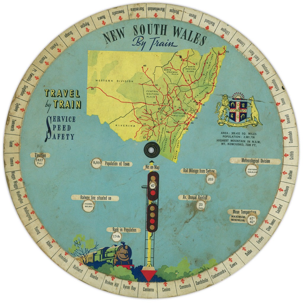
Historical Map: New South Wales By Train Information Wheel, 1938
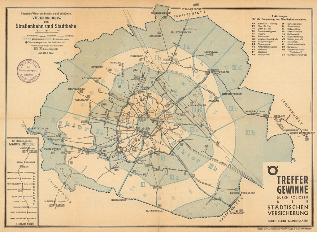
Historical Map: Strassenbahn and Stadtbahn Map, Vienna, Austria, 1933
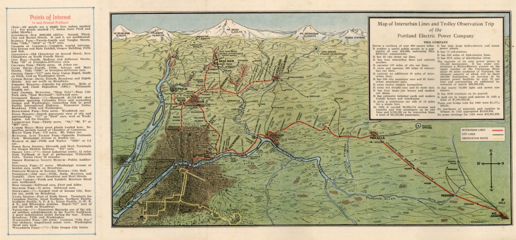
Historical Map: Map of Interurban Lines and Trolley Observation Trip, Portland Electric Power Company, c. 1923
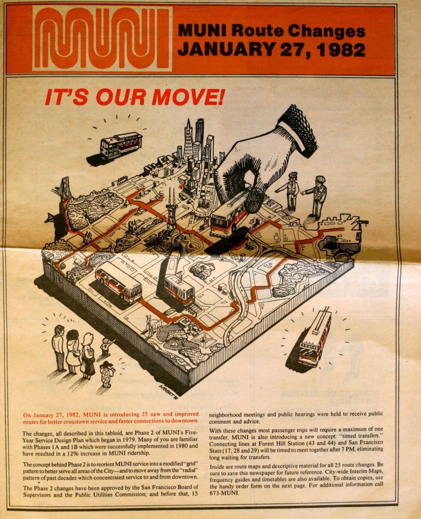
MUNI Route Changes, January 27, 1982
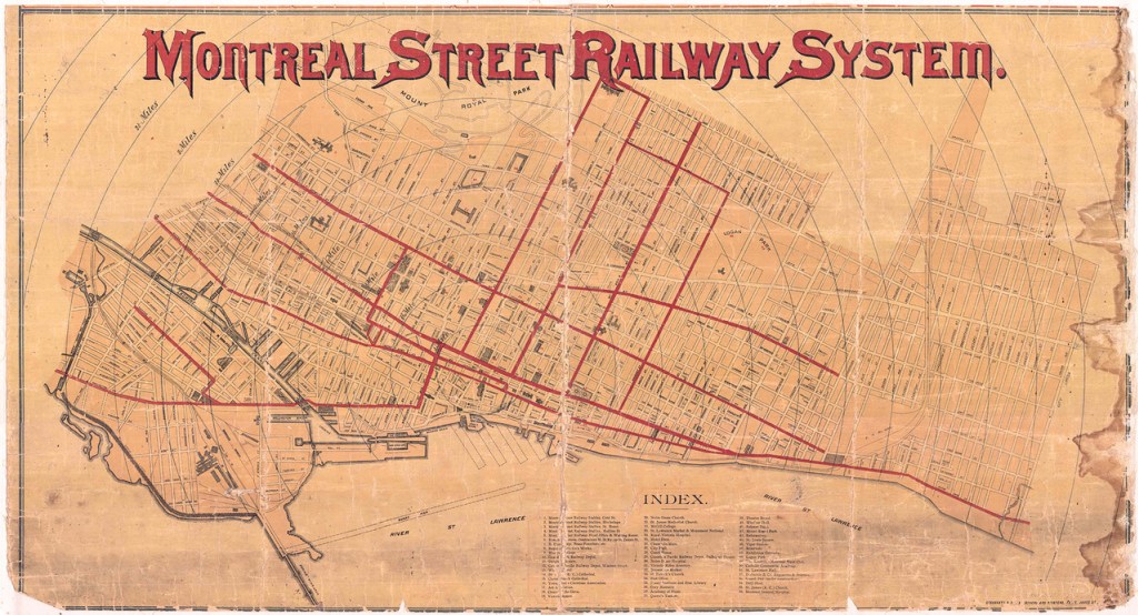
Montreal Street Railway System, 1893