Readers:
As I have mentioned in past posts, one of my favorite illustrators is Richard Johnson (photo, right). If you search on his name on my blog site, you will see several different examples of his work I have highlighted before.
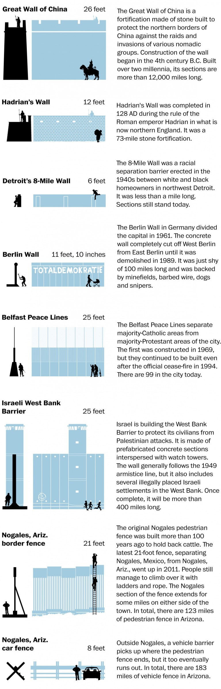
Richard created the following infographic last year and it is titled From the Great Wall of China to the Southwest border: A historical guide to separation walls.
Here are Richard’s thoughts about creating this infographic.
A separation barrier/defensive wall is designed to limit the movement of people across a certain line or border, or to separate lands in order to protect people or cultures. They have been used for many thousands of years and built in a variety of materials, shapes and scales. Here are some famous examples and their maximum height to scale:
Later this week, I plan to show some data visualizations related to building a wall between Mexico and the USA, what it will cost, and what it would realistically take to build it. Also, I will show data asking the question if it is really necessary to build it.
Best regards,
Michael
Sources: Jon Henley: An illusion of security from Berlin to the West Bank,PBS.org, UNESCO and the Federation of American Scientists | Richard Johnson/The Washington Post
+

Just electrify the fence, then have them try to climb over it.