Where the Germanwings Plane Crashed
The plane went down in a remote part of the Alpes-de-Haute-Provence department, and search teams struggled to get to the area. When French air traffic controllers lost contact with the aircraft, it was flying at approximately 6,000 feet; the elevations in the search area range between 2,000 and 9,000 feet.
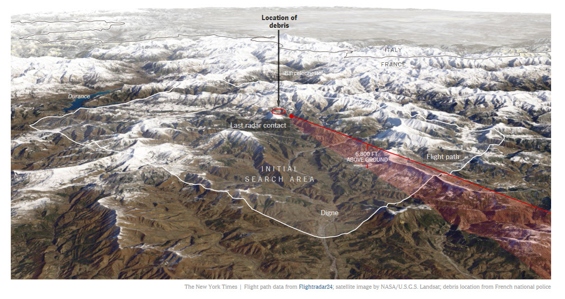
No helicopters have been able to land because of the rugged terrain around the crash site. Searchers had to be lowered, further slowing recovery efforts. The size of the debris area, which was about the size of three to four football fields, suggests the plane hit the ground at a very high speed, according to the French interior minister, Bernard Cazeneuve.


Source: New York Times, Where the Germanwings Plane Crashed, March 25, 2015, http://www.nytimes.com/interactive/2015/03/24/world/europe/germanwings-plane-crash-map.html?smid=tw-nytimes&_r=1.
